The map screen
The in-flight map: where you are, the airfields and other jets, and the ruler for bearings and distances.
On this page
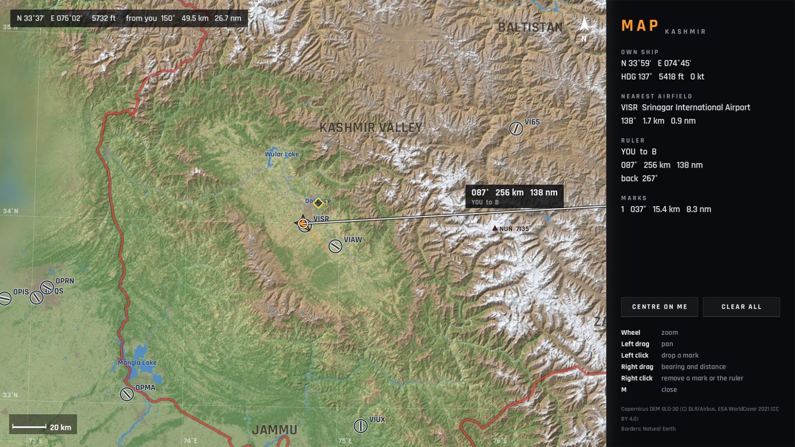
Press M to open the map, and M or Esc to close it. The flight carries on underneath: the map is not a pause, so keep an eye on your jet.
What it shows
- A shaded relief chart of Kashmir with a latitude and longitude grid and the red outline of the region.
- Airfields with their runways.
- Your jet, with your track.
- Other jets: blue for friendly, red for enemy, yellow for other players.
- Named peaks (K2, Nanga Parbat, Rakaposhi, Nun), lakes and regions.
It opens zoomed in around you and follows you until you move it. Sharper detail fades in as you zoom.
The side panel
| Section | Shows |
|---|---|
| OWN SHIP | Latitude and longitude, heading, altitude (ft) and ground speed (kt) |
| NEAREST AIRFIELD | Its code and name, bearing and distance |
| RULER | The bearing and distance you are measuring |
| MARKS | Bearing and distance to each of your marks |
| CENTRE ON ME | Moves the map back to your jet |
| CLEAR ALL | Removes all marks and the ruler |
Distances are shown in both kilometres and nautical miles.
Using the mouse
| Mouse | Action |
|---|---|
| Wheel | Zoom in and out (about your jet while the map follows you, about the pointer once you have moved it) |
| Left drag | Move the map |
| Left click | Drop a mark (up to 9) |
| Right drag | Measure with the ruler: bearing, distance and the reverse bearing, and when it starts at a jet, the time to get there at that jet's speed |
| Right click | Remove a mark or the ruler |
The ruler snaps to jets, airfields and marks, and holds on: measure to another jet and the ruler follows it as it moves.
Checked against FlightOut 0.5.1.